


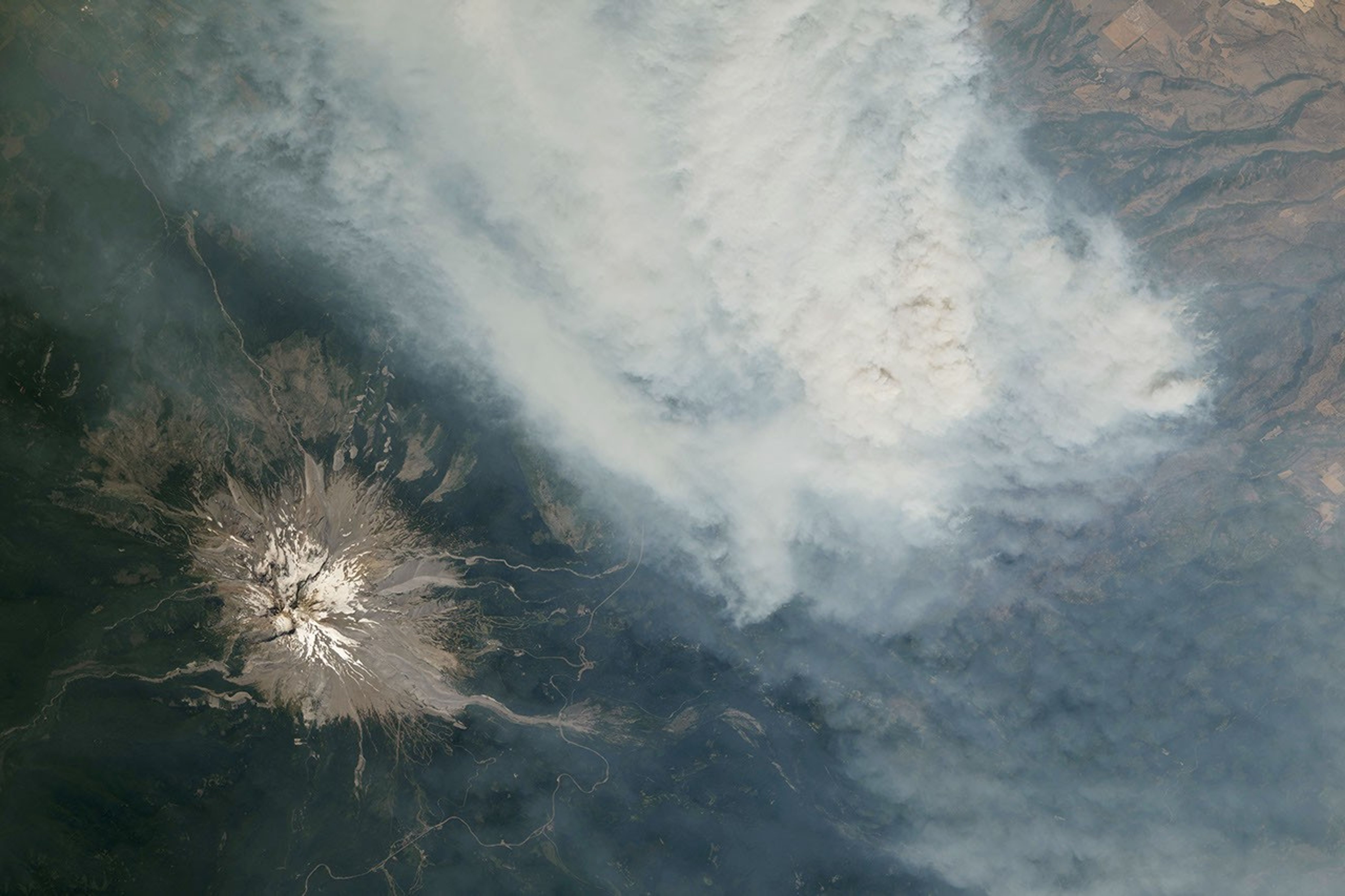
In a contrast of fire and ice, smoke from wildfires mixed with several of the Cascade Range’s prominent glacial volcanoes in the summer of 2026. Astronauts from the International Space Station photographed the scene while orbiting over the western US in late July and early August.
Mount Hood, Oregon’s highest peak at 11,249 feet (3,429 meters), is shown above, near a thick plume of smoke billowing from the Grasshopper Fire. Storms passed over the forest in the preceding weeks, and lightning on July 23 ignited the fire shown in this July 31 photo. The fire, burning east of the mountain, quickly spread north and east through the Mount Hood National Forest amid hot, dry conditions, according to InciWeb.
As of August 12, it had burned nearly 84,000 acres (34,000 hectares) and had spread beyond the boundaries of the national forests. Several communities in Wasco County were under “go now” evacuation orders, and the nearby town of Dufur was advised to prepare for an immediate evacuation.
About 100 miles north in Washington, Mount Rainier, the state’s highest peak at 14,411 feet (4,392 meters), was shrouded in smoke. There were no major fires nearby when this photograph was taken on August 4. Instead, the smoke came from fires in central and eastern Washington, carried by winds blowing from the east due to a high-pressure system offshore. That day, the National Park Service reported that air quality in the park reached unhealthy levels due to elevated concentrations of fine particulate matter (PM2.5).
Several days later, the Grand Park 2 Fire was observed burning within the park boundaries, about 3 miles north of the Sunrise Visitor Center. As of August 12, the fire had burned 223 acres (90 hectares) and was not contained; the cause had not yet been determined.
Above-normal fire potential was expected to persist across the Northwest into August, according to an outlook from the National Interagency Fire Center. Hot, dry weather (El Niño-influenced conditions) combined with cured fuels to set the stage for large, long-lived fires following lightning- or human-caused ignitions.
Photographs of astronauts ISS075-E-1705 and ISS075-E-2221 were acquired on July 31, 2026 and August 4, 2026, respectively, with a Nikon Z9 digital camera with a focal length of 400 millimeters. They are provided by the ISS Crew Earth Observation Facility and the Earth Sciences and Remote Sensing Unit at NASA Johnson Space Center. The images were taken by an Expedition 75 crew member. The images have been cropped and enhanced to improve contrast and lens artifacts have been removed. The International Space Station Program supports the laboratory as part of the ISS National Laboratory to help astronauts take photographs of Earth that will be of great value to scientists and the public, and to make those images freely available on the Internet. Additional images taken by astronauts and cosmonauts can be viewed at NASA/JSC Gateway to Astronaut Photography of Earth. Story by Kathryn Hansen.
Mount Rainier: August 4, 2026
- InciWeb (2026, August 12) Grand Park 2 Fire. Accessed August 12, 2026.
- InciWeb (2026, August 11) Grasshopper Fire. Accessed August 12, 2026.
- National Interagency Fire Center Predictive Services (2026, August 1) National Outlook for Significant Wildfire Potential. Accessed August 12, 2026.
- OPB (2026, August 11) Fire growth near Mount Hood prompts new evacuations in Wasco and Clackamas counties. Accessed August 12, 2026.
- Washington Smoke Blog (August 4, 2026) Smoke continues to build up across the state with gradual improvement expected later this week. Accessed August 12, 2026.
Source link


